
 |
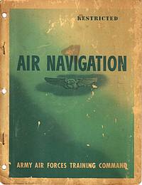
Air Navigation

Direct link to this page:
https://aafcollection.info/items/list.php?item=000198
Authors:
- none listed
Contributors:
- Mike Voisin
Published: Army Air Forces Training Command, circa 1944
Published by the Army Air Forces Training Command Visual Training Department, from technical material furnished by the Army Air Forces Instructors School (Navigator), Selman Field, Monroe, Louisiana. To be used in conjunction with current AAF Training Command memorandum covering Advanced Navigation Training.
This textbook was used to teach advanced navigation at San Marcos Army Air Field in 1944 and 1945. It is extensively illustrated with diagrams to explain virtually all material covered in the text.
More Details
Hide Details
Item: 000198
Viewed: 14955 times
Comments: 14 (see below)
Categories:
- Navigation
- Training
Special Features:
- Owner - Includes the name of the original owner
Locations:
- Selman Field; Monroe, Louisiana, USA
- San Marcos Army Air Field; San Marcos, Texas, USA
Contributors:
- Mike Voisin
Repositories:
- Private Collection
Collections:
- John E. Voisin
Added: September 21, 2009
What can I do with this item?
Hide
 To View this item, click
  .
.
To View this item when it's at another website, click ![]() .
.
![]() To Print this page, choose a printer-friendly version with or without comments.
To Print this page, choose a printer-friendly version with or without comments.
(Then use your browser's Print command, followed by Back to return here.)
 To Tweet about this item at Twitter, click Tweet
 To Pin this item at Pinterest, click
 To Link directly to this item:
https://aafcollection.info/items/list.php?item=000198
![]() To Cite this website as a research source:
To Cite this website as a research source:
Army Air Forces Collection, "Air Navigation" (item 000198), AAF Collection, https://AAFCollection.info/items/list.php?item=000198 (accessed 26 April 2024).
 |
|
This is the complete document, including the sections detailed below, and except for the fold-out star charts before the inside back cover.
29Mb |
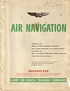 |
Front matter, chapter outlines and back matter The book does not have a table of contents or index. However each section has its own outline of the material covered. This section has the front and back covers, the title page and introduction. It also combines the pages of outlines from each section.
|
|
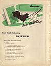 |
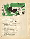
Section 1: Basic Dead-Reckoning Basic Ideas in Dead-Reckoning: The earth; The coordinate system of locating points on the earth; Direction on the earth; Linear distance on the earth. Tools Used in Basic Dead-Reckoning: Lambert conformal chart; Map reading; Plotting on the Lambert conformal chart; Time-speed-distance problems: arithmetic, computer, and table solutions. Basic Dead-Reckoning Techniques: Pre-flight preparation; Determination of groundspeed (GS); Calculations of estimated time of arrival (ETA); Correction for off-course. Basic Dead-Reckoning Procedure: Pre-flight procedure; Procedure at take-off; Keeping station; Procedure at check-points; Procedure to correct for off-course; Procedure at destination; Close-out procedure.
|
|
 |
Section 2: Precision Dead-Reckoning Basic Ideas and Tools of Precision Dead-Reckoning: Headings (horizontal position); Altitude (vertical position); Airspeed and groundspeed; The effect of the wind. Charts For Precision Dead-Reckoning: The Mercator plotting sheet; The Lambert conformal and other charts for precision dead-reckoning. General Techniques Employed in Precision Dead-Reckoning: Vector solutions; Keeping up with altitude; Keeping up with heading, airspeed, and air position (keeping the airplot); Keeping up with the effect of the wind; Keeping up with track, groundspeed, and ground position (keeping the ground plot); Using the airplot and the ground plot for ETA's, etc. Precision Dead-Reckoning Procedure: Chart work: airplot, ground plot, combinations; The log. Specialized Techniques in Precision Dead-Reckoning: Determination of instrument and installation error; Groundspeed by timing; Controlled groundspeed; Fuel consumption charts; Great circle routes; Patrol and search; Interception; Radius of action to same or alternate base.
|
|
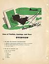 |
Section 3: Lines of Position, Bearings, and Fixes The Need for Checking Dead-Reckoning: Reliability of dead-reckoning depend upon accuracy of calculations; Need for checking dead-reckoning calculations by observations; The idea of origins. The Line of Position (LOP): Basic idea and examples; Kinds of LOP's; Types of LOP's; Advancing an LOP. Bearings: Basic idea and measurement of bearings; True, magnetic, and compass bearings; Relative bearings; Relations between true and relative bearings; Reciprocal bearings and LOP's. The Fix: True fix: intersection of two or more simultaneous LOP's; Running fix by advancing one or more LOP's; Order of taking LOP's for fix; course line to advance to speed line; Spacing LOP's to get good cut; Fix from three LOP's; Combining various kinds of LOP's to get a fix. Plotting and Labeling LOP's and Fixes: Plot LOP's to be advance as broken lines; Plot LOP's establishing a fix as solid lines; Labeling LOP's; Indicating and labeling fixes. Aircraft Instruments For Measuring Bearings: Driftmeter; Compass; Astro-compass; Radio instruments; Celestial instruments; Leading or trailing edge of wing, etc.
|
|
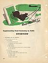 |
Section 4: Supplementing Dead-Reckoning by Radio The Radio Line of Position: The instruments and their use; Obtaining the uncorrected radio bearing; Converting uncorrected radio bearing to radio line of position; The radio fix and log; Other radio and communication equipment in the aircraft. Additional Radio Aids: Radio range stations; Marker beacons.
|
|
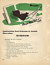 |
Section 5: Supplementing Dead-Reckoning by Celestial Observations Obtaining the Line of Position: Basic ideas; Solving for azimuth and intercept; Plotting the line of position; Classifying lines of position. Using Lines of Position in Simple Problems: As a check; The landfall. Some of the Theory Behind the Line of Position: The celestial sphere; The heavenly bodies; Time and the chronometer. Using the Line of Position in More Complex Problems: Latitude by meridianal altitude; Compass correction; Pre-computation; Position-finding: the fix.
|
|
 |
|
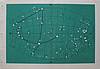
Appendix: Star Charts The book has seven pages of fold-out star charts that appear after the last page of the last section and before the inside back cover. Due to their larger size, they are provided here in two separate sections. This section contains five charts, each depicting 65 degrees north to 65 degrees south declination.
0.6Mb |
 |
|
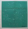
Appendix: Star Charts (Continued) This section contains two star charts, a north polar projection, and a south polar projection, each depicting 10 degrees to 90 degrees declination.
0.4Mb |
Comments (Add a Comment)
[2] Melissa (07-Jan-2010 01:03 PM)
Thank you for maintaining this site and putting things like this up on the web. My grandfather served in the Army Air Corp. and my boyfriend is currently a navigator in the Air Force. I'm sure he'll be fascinated to see this book. Thanks again for your work in preserving history!
[3] Kenneth Erickson (21-Dec-2011 12:57 AM)
Excelent. I will enjoy reading this rare document. I have AF Manual 51-12 Dead Recokooning and AFM 51-40 1973.
[4] Pui (27-Jun-2012 06:23 AM)
Thank you for sharing this book. Now I have a feeling of what my father went through receiving his training in being a pilot (Thunderbird field), bombardier (Carlsbad) and navigator (Ellington field?) in the US in WWII. He was a Chinese air force cadet at the time.
PT
[5] Ray Godburn (02-Nov-2012 05:46 PM)
Very cool site and docs. My father graduated class
44-47N in Nov. 1944. Do you know of any sights that I might find this same kind of info for his class?
[6] Judeye (02-Jan-2013 04:04 PM)
This is such a great resource for learning about aviation training in World War II...much appreciated!
[7] Phil True (24-Jan-2014 07:36 AM)
I graduated in class 44-51N, San Marcos, Dec. 1944. In the Pacific navigating B-29s to Japan and back, celestial navigation was very important. Once near or over Japan, the APQ 15 radar set was our greatest help. Navigation was extremely important in that on daylight missions, one had to assemble by groups--normally 30 planes--at a set of coordinates perhaps 50 miles off the coast of Japan. Each plane was flown individually--not in formation--before assembling and flying to the IP--the initial point--to begin the bomb run.
[8] Mike Radowski (30-Dec-2014 09:30 PM)
With your permission, I would like to add these Navigator Pubs to my USAF Navigator History Web Site. http://www.usaf-nav-history.com. Also, if you would have a picture of the Nav Station and the Bombardier, they would be greatly appreciated.
Thanks
Mike
[9] Bill (20-Feb-2015 11:39 PM)
Thank you for making this manual available. My father was an instructor at Selman Field. I will very much enjoy reading this.
[10] Edward Popko SN (14-Jul-2015 05:45 AM)
What a wonderful public service this posting is. Thank you for going to the effort to organize this and make if available.
[11] NavBarrett (22-Sep-2015 02:38 AM)
This is a great post of an important core-tech manual used by WWII navigators.
There are many more Nav manuals+photos+the AF Navigator magazine compiled in/on a thumb drive compiled by the Air Force Navigators Observers Association (www.afnoa.org) called the AF Navigators' Comprehensive History.
This AFNOA file is of 11,000 pages of high resolution pdf'd scanned images of all we could find and were sent into AFNOA. It is 32gB uncompressed! It is 2.2 in a lower res drive. And is broken into Ten-sections from prior to WWII to 1985-present-GPS times.
Please contact AFNOA, or the USAF at Maxwell AFB, AF/Historical Research Agency or Academy as they all have copies of this pdf drive & its content.
AFNOA members get this Nav history for a donation as AFNOA is a 30+year old Navigator's organization that supports our history and all the USAF Filed Museums. I am the AFNOA Historian and we greatly appreciate this posting.
[12] Ken Lawson (26-Dec-2018 02:31 PM)
Thank you very much for publishing this immensely valuable historical resource.
[13] Antonio Aldana (10-May-2023 09:06 PM)
Excellent book. I like it very much. Thanks to manuals like this one our aviators during wwii were able to do their great job. Thanks you for giving it to all of us.
[14] Joseph (04-Sep-2023 03:38 PM)
Thank you. amazing work
End of Comments
Add a Comment
|
Use this form to add a comment about this item! Why should I leave a comment? Hide Reasons to leave a comment include:
|
|
Curator: Mike Voisin
|
|
Army Air Forces Collection Item 000198 is licensed by Mike Voisin under a Creative Commons Attribution-NonCommercial-ShareAlike 4.0 International License. |

[1] Mike Voisin (21-Sep-2009 03:49 PM)
This book belonged to my father, Second Lieutenant John E. Voisin, while he was stationed at San Marcos Army Air Field, San Marcos, Texas. He graduated as a navigator in class 45-10N-F.